Severe Weather Brings Hail – Knocks Out Power – More Expected Tonight Into Thursday
Quite the light show was being reported during the overnight hours as a round of strong-to-severe storms pushed its way across parts of the lake area.
Strong winds up to around 60 miles-per-hour, pea sized hail and more than 270 without power for a time were also reported in the Laurie and Gravois areas on the west side.
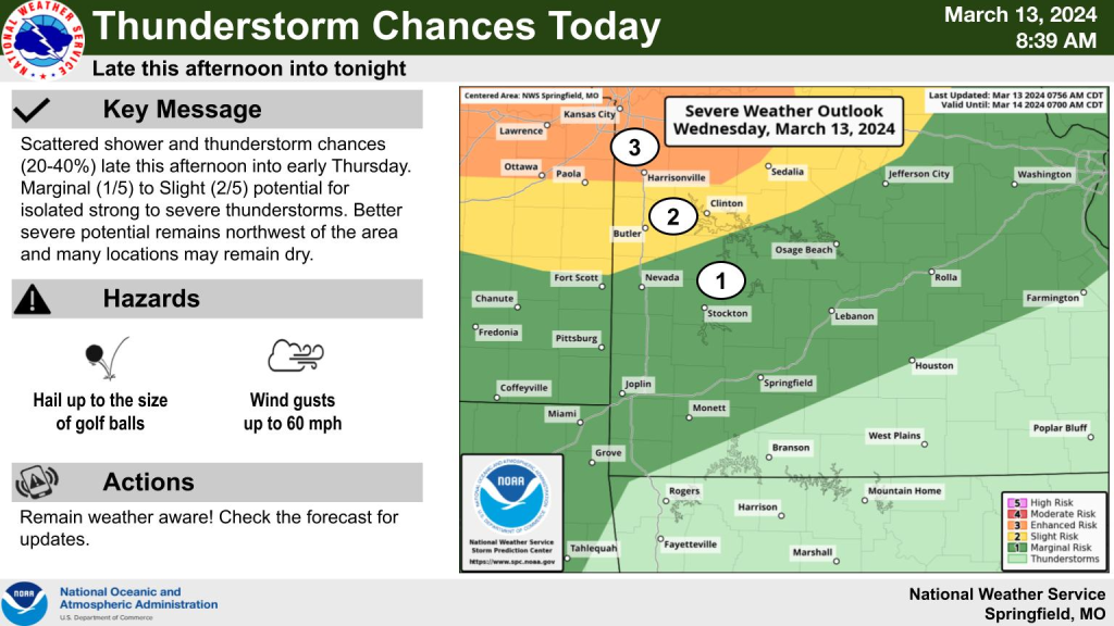
The potential for another round of strong storms in the lake area is possible again today into tomorrow.


This Hazardous Weather Outlook is for portions of the Missouri
Ozarks and extreme southeast Kansas.

.DAY ONE...Today and Tonight.

Weather hazards expected...

  Limited hail risk.
  Limited thunderstorm wind damage risk.
  Limited lightning risk.
  Limited non thunderstorm wind risk.

DISCUSSION...

Additional thunderstorm chances, 20 to 45 percent, will occur this
afternoon into tonight. There will be the potential for severe
storms with hail to the size of golf balls the main risk, with
damaging wind gusts a secondary risk. The overall better severe
potential looks to remain just northwest of the area this
afternoon through tonight.

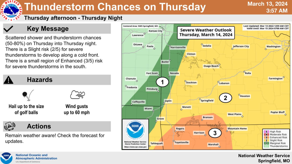
.DAYS TWO THROUGH SEVEN...Thursday through Tuesday.

A cold front will move through the area Thursday afternoon into
early Friday morning. Additional storms will develop along the
front and there will be the potential for strong storms with
large hail to the size of golf balls and damaging wind gusts the
main risks. Locally heavy rainfall will also occur and could lead
to a localized flooding risk mainly across far southern Missouri
Thursday evening and night. The highest chance for showers and
thunderstorms will be late afternoon into the early overnight
hours.

Gusty northerly winds and a dry air mass could lead to elevated
fire weather conditions this weekend into early next week.

.SPOTTER INFORMATION STATEMENT...

  Spotter activation will not be needed through tonight.


