Tornado Watch In Effect For Portions Of The Lake Area
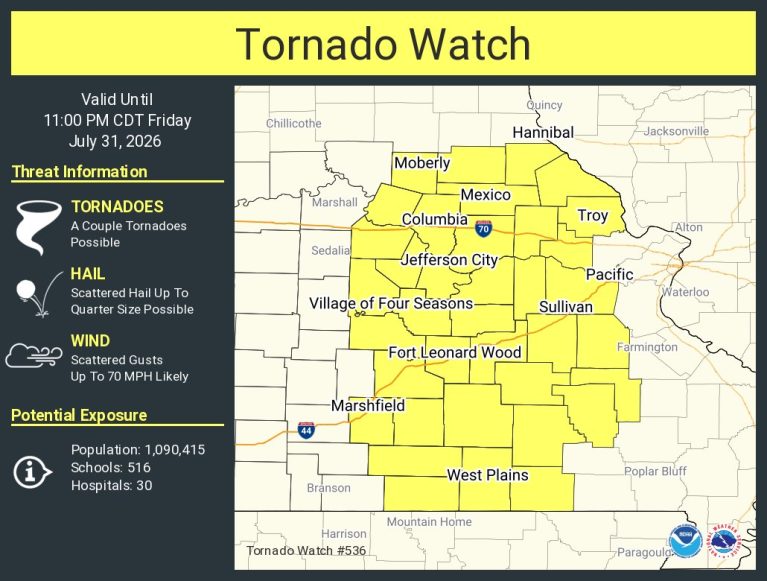
The National Weather Service has issued a Tornado Watch for parts of the Lake Area, including Camden, Miller, Morgan, Laclede, Pulaski, Cole and Maries Counties until 11PM.
SUMMARY…Potential for damaging wind and a couple of tornadoes to
increase through the afternoon/evening.
DISCUSSION…Air mass recovery is ongoing across portions of western
and central Missouri behind morning thunderstorm activity. A surface
low is currently located across central Iowa, with modest south to
southwesterly flow and temperatures warming back into the mid 80s
across Missouri. SPC Mesoanalysis depicts higher theta-e air
advecting in from the southwest and a nose of MLCAPE values around
1000-2000 J/kg are slowly shifting northward into portions of
north-central Missouri. Additionally, visible satellite shows
cumulus becoming increasingly agitated near the front.
This destabilization ahead of the approaching front will be
sufficient to support redevelopment of severe storms over the next
couple of hours both near the front and along surface convergence
with the surface trough in central Missouri. Deep layer shear around
35-40 kts will support supercells. The main threats will likely be
damaging wind and a couple or tornadoes. Tornado potential will be
best where surface winds have a southeasterly component maximizing
low-level SRH. This zone appears most likely across portions of
central/eastern Missouri near the surface trough. A watch will
likely be needed to cover these potential threats in the next couple
of hours.

Reporter John Rogger