Severe Weather Expected To Hit The Lake Area Monday Night Into Tuesday Morning
The National Weather Service says keep your eye on the sky and your NOAA weather radios on throughout the night tonight.
Officials are expecting possible severe weather through the early Tuesday morning hours, including damaging winds, tornados and hail.
KRMS Will also keep an eye on the weather, and should severe storms occur…you can follow along on our social media channels, tune in via our various radio stations or follow the National Weather Service office in Springfield on Twitter for the latest updates.
 Here’s the full report as of 2PM from the NWS Office:
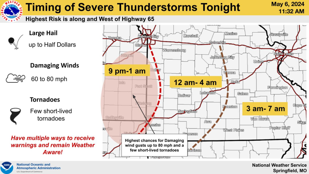
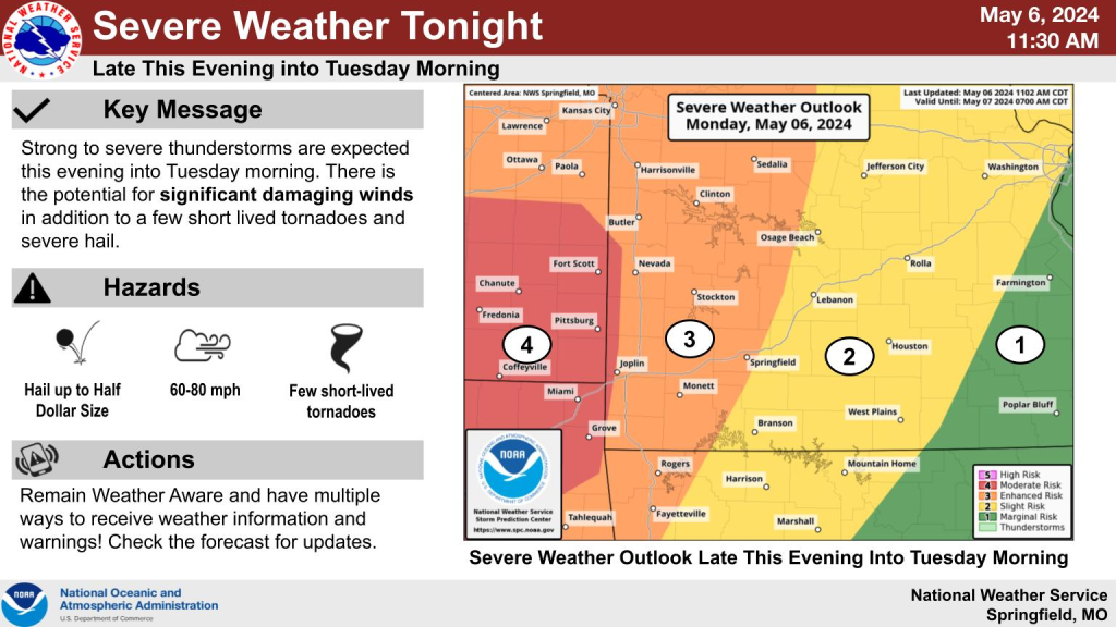
Severe thunderstorms are likely tonight as a line of
thunderstorms approaches far southeast Kansas by 9pm and then
moves east through southwest Missouri overnight. The line of
storms will likely be out of the area by sunrise Tuesday.

Widespread damaging winds of 60 to 80 mph is the most likely
risk, especially along and west of Highway 65. However, there will
be the potential for brief, short lived tornadoes. Large hail up
to the size of half dollars and frequent lightning will also be a
concern. Locations west of Highway 65 will also have a localized flooding
risk overnight.

SPOTTER INFORMATION STATEMENT...

 Spotter activation may be needed tonight for southeast Kansas and
southwest Missouri.

Reporter John Rogger