NWS Now Confirms Multiple Tornadoes Across The Lake Area Friday Night
Updates:
The National Weather Service continues to assess the damage and has now indicated there were two separate Tornadoes in Gravois Mills, thus making the total so far for the Lake Region of 5 Tornadoes across Benton & Morgan Counties.
Previous Story:
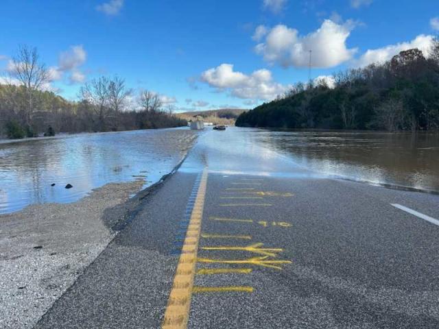
The Lake Area was hit by multiple Tornadoes during the severe storms on Friday evening.
The National Weather Service says there were five tornadoes across Benton and Morgan Counties.
In Benton, an EF-1 started south of the Truman Dam and tracked to the northeast across Highway 65, with peak winds of about 90 miles-per-hour, while the second tornado, an EF-0, briefly touched down a mile northeast of Whitaker.
In Morgan, an EF-1 touched down in North Gravois Mills, between highway TT and seals road, going at about 90 miles-per-hour. Another twister, an EF-0 with winds at 80 miles-per-hour, hit at HWY 135 and traveled northeast to McCasland road.
Finally an EF-0 hit north of Barnett between Highway 52 and Highway OO, with winds at around 85 miles-per-hour.
There were several reports of damage but fortunately no reports of any injuries.
Reporter Mike Anthony