Severe Storms Set For The Lake Area Again On Wednesday
Coming on the heels of some severe weather hitting parts of the lake area during the overnight hours Tuesday morning, what could be another rough weather day is being forecasted for Wednesday morning.
“Most of the Severe stuff coming in tomorrow will be during the day, which is good,” says Weatherology Meteorologist Cara Foster, “We don’t need anything nocturnal…nocturnal storms are very scary, especially when we have more of an enhanced risk of severe weather throughout the area.”
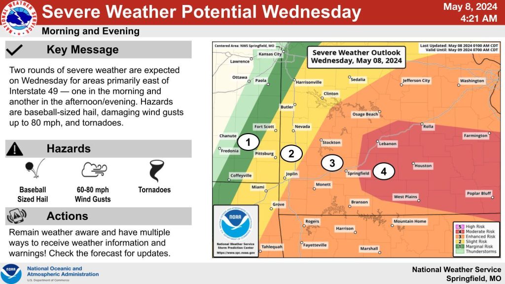
She says that all modes, once again, will be possible…with large hail being the main threat…”Mainly going to be some winds, some hail and also some Tornadoes are possible throughout most of the state.”
From the NWS:
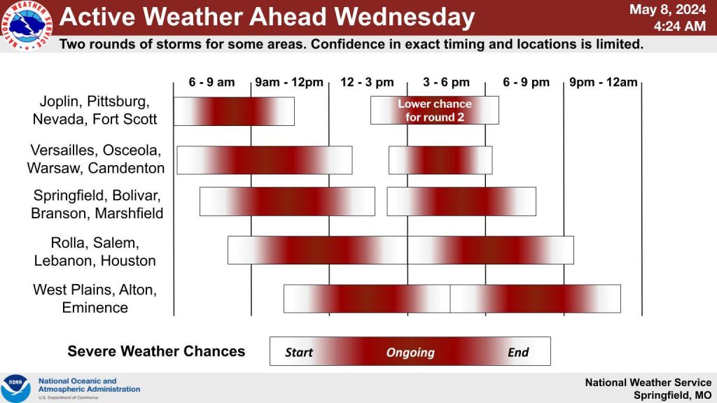
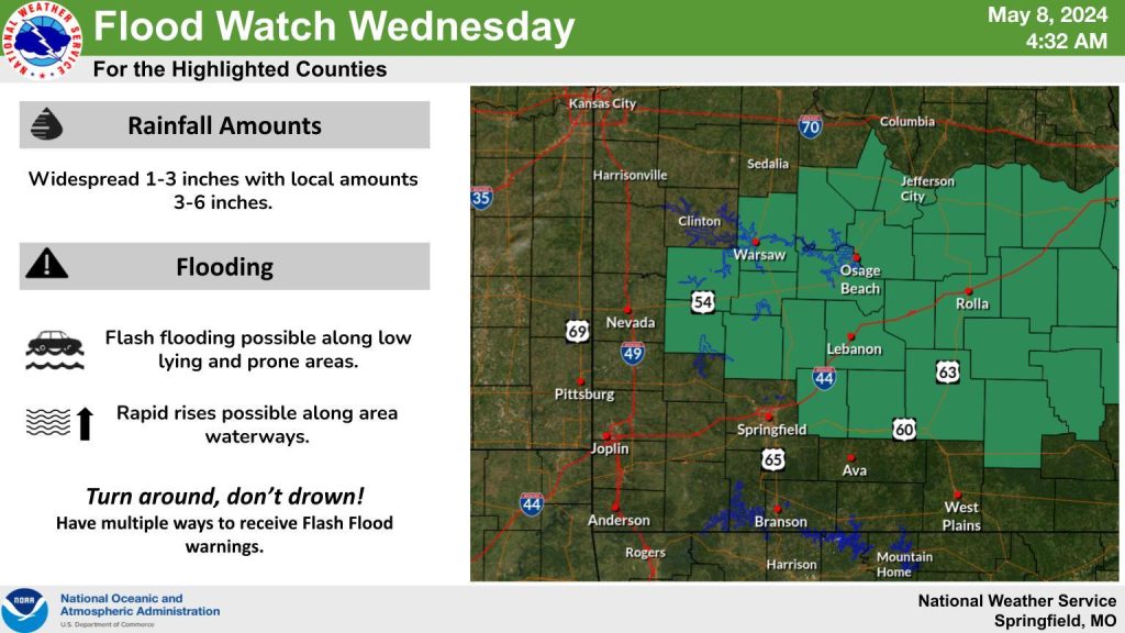
This Hazardous Weather Outlook is for portions of the Missouri
Ozarks and extreme southeast Kansas.

.DAY ONE...Today and Tonight.

Weather hazards expected...

  Elevated tornado risk.
  Significant hail risk.
  Significant thunderstorm wind damage risk.
  Significant lightning risk.
  Elevated excessive rainfall risk

DISCUSSION...

Severe thunderstorms are likely this morning through this evening
with very large hail up to the size of baseballs, damaging winds
up to 60-80 mph, and tornadoes. The first round is expected in
the morning to mid afternoon with round two in the late afternoon
and evening. Highest potential for severe storms is along and
southeast of a Joplin to Warsaw line.

Localized heavy rainfall may result in flooding, especially for
areas northeast of a line from Stockton to Marshfield to Eminence.
A Flood Watch has been issued for this area, where storms may drop
1 to 3 inches of rain with locally higher amounts of 3 to 6
inches.
Reporter Mike Anthony